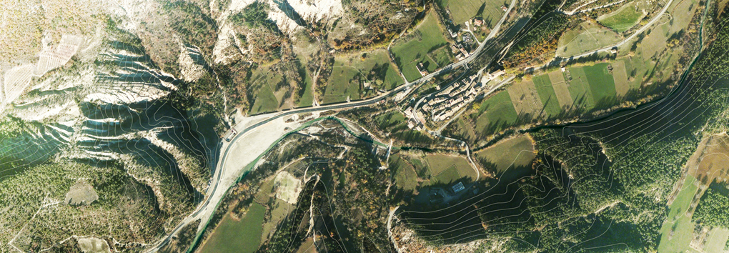
Sedimentary deposits that slowly accumulated on the bottom of the sea, which once covered the region, were disturbed by the uplifting of the Alps.
These movements produced east-west folding of the rock strata, as you can see on the relief map.
Then, the action of water, frost, wind, and according to the hardness of the rocks, erosion slowly sculpted the mountains and created this complex landscape. Let’s take a closer look at the shapes of the terrain.
Here the stratum is laid bare and reveals the powerful mechanisms that created the mountains and valleys, the cliffs and ravines.
The rocks that make up the terrain here are composed of sedimentary deposits that slowly accumulated in a trench in the sea that once covered the region. These rocks were then displaced by tectonic movements.
These movements, which began in the Upper (late) Cretaceous epoch, produced east-west folding of the rock strata, as you can see on the relief map.
Finally, through the action of water, freezing and thawing, wind, and according to the hardness of the rocks, erosion slowly sculpted the mountains and created this complex landscape typical of the geomorphology of Les Baronnies and Diois.
This erosion exposed the rocks of Serre de l\'Ane. With its alternating layers of limestone and marl, the La Charce site is highly representative of the region’s geological formations.

